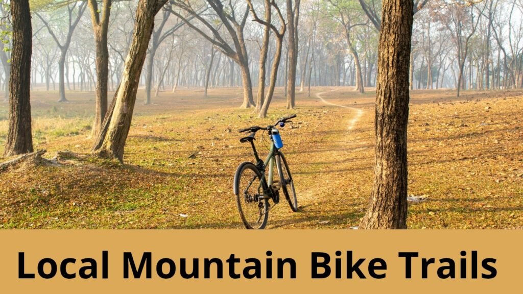
Are you looking for local mountain bike trails near you? Then you’re at the right place.
There are many trails in the United States and in other countries, including Canada, the UK, India, the Philippines, etc. But sometimes, it’s overwhelming to find the right one.
However, in this guide, I will share some practical tips on how to find the best trail near you.
Start with Online Trail-Finding Platforms

First and foremost, you would like to take advantage of technology.
There are many websites and apps that allow you to find mountain bike trails near you.
These tools provide a detailed map and trail description, such as:
- What you can expect
- Is it for beginner, intermediate, or advanced?
- User reviews
- Real-time updates to give you an idea of whether you should ride or not, depending on forecast or weather conditions.
Here are a few apps that you can use to find trails:
Trailforks
Trailforks is the most famous platform, and it covers everything.
For example, it gives you a map based on your difficulty level. If you are a beginner or an expert, you can just tell your skill level, and you will get trails according to it.
It has GPS tracking options available online and offline, which is really helpful in remote areas where network or cell service is not available.
Trailforks also provides trail condition reports and updates through the mountain biking community, including closures and hazards.
Plus, it suggests popular routes and heatmaps to show how frequently other riders visit it.
You can visit Trailforks if you are looking for up-to-date trail data and advanced features like elevation profiles, technical readings, etc.
MTB Project
MTB Project is another alternative to Trailforks. It is designed for mountain biking enthusiasts and is backed by REI.
It also provides detailed trail descriptions, elevation gain, estimated riding time, etc.
Like Trailforks, MTB Project has GPS-enabled maps and turn-by-turn navigation features.
Besides this, you can see high-quality photos and personal reviews from other riders to view the trail conditions, especially how it is built and whether you should ride there.
Additionally, you can download trail maps to access them offline.
MTB Project is fantastic if you would like to see more visuals like photos and personal insights before planning your ride.
AllTrails
Alltrails is also a good platform specifically designed for hikers. They have solid sections for multi-use trails, which is suitable for biking.
Some of the key features of Alltrails are as follows.
It has an easy-to-use interface, GPS tracking to explore new routes, and a filter to find dog-friendly and kid-friendly trails, so you can even go there with your kids or family members.
Users submit photos about the trail conditions, such as MTB Project, reviews, notes, etc.
Lastly, It has offline map downloads, but you must pay for the subscription.
Alltrails is suitable for casual riding who also enjoy hiking. Besides this, it is also good to find beginner-friendly routes.
Pro tip: If you have found any trail that suits you through any of these websites or apps that I mentioned, like Alltrails, MTB Project, and Trailforks, you should check the actual trail conditions, like weather events, maintenance closures, seasonal restrictions, etc.
Also read: 4 Week mountain bike training program to build endurance, habit, & boosting confidance
Ask Local Riders and Bike Shops for Trail Advice

Online websites and apps are very useful, but local knowledge is also very important.
Local people can provide very insightful information that can provide important insights that are not even available on apps or online platforms.
So here is how you can find local people there and use their expertise to discover mountain bike trails near you.
Visit Your Local Bike Shop (LBS)
Sometimes, local bike staff can help you as some of them are seasoned riders, so they know the area very well. The staff will tell you about the hidden gems such as:
- trails that are not listed on the app or website
- Trail trail condition
- Maintenance updates
Plus, they will suggest a trail based on your skill level while giving you bike setup tips, like gear and adjustment based on the local terrain, etc.
Besides this, some shops also host group rides, which is a good opportunity to test trails with experience and locals, as well as learn techniques.
Connect Through Local MTB Groups and Forums
You can use forums, websites, and apps, such as, you can join Facebook groups, Reddit threads, local MTB forums, etc., to get more information from MTB community members.
They share recent updates on trail disclosure, repairs, hazards, etc.
Besides this, they offer ride recommendations based on your needs, such as beginner-friendly, downhill-technical, etc.
Some Facebook groups also organize meetups for rides.
Pro tip: You can search for a group by typing your city name and typing mountain bikers, or MTB riders,
Search Example: MTB rider in Colorado
Attend MTB Events and Clinics

You can also look for MTB events, like skills clinics and demo days, that are hosted by shops and local organizations.
These MTB community gatherings will help you meet experienced riders and allow you to test new trails and get tips to improve your riding skills and build a knowledge base.
For example, they’ll share some hidden gems that aren’t listed on websites and that many people don’t know about.
Additionally, if you are riding in a park or trail system that is managed by local authorities, then you can talk to trail volunteers or park rangers about the updates and info on future development.
Also read: Mountain Biking Etiquettes That You Need To Follow
Use Google Maps and Satellite View

Google Maps, especially the satellite view, can also help you find trails that aren’t listed on mountain biking community apps and websites like Alltrails, MTBprojects, etc.
Many people don’t even use Google Maps and satellites.
However, here is how to find trails using Google Maps.
Switch to Satellite View:
- Download and open Google Maps
- Tap the layers icon (usually in the corner).
- Select Satellite View to see detailed aerial images of MTB terrain.
Tip: Look for large green spaces like forests or hilly areas, which are common places for bike trails.
Zoom In on Trails:
- You can scan for thin, winding paths that are going through green spaces.
- Look for routes that look like zigzags or snakes up and down slopes, as they often indicate biking or hiking routes.
- Also, pay attention to trail intersections, parking areas, and visible trailheads.
Use Terrain View (Optional):
You can switch to terrain view for a clearer idea of elevation changes and contours because most trails in elevation areas are designed for advanced riders, as they’re more technical.
Check for Access Points:
Once you’ve found a suitable trail based on your skill level and interest, you want to look for roads or parking lots nearby.
You can find trailheads, picnic areas, or recreational facilities as they’re often entry points.
Verify with Street View:
- Drag the yellow Street View icon to roads near the trailhead.
- Look for signs, parking lots, and kiosks that confirm public access.
- Also, look for obstructions like fences, gates, or “No Trespassing” signs to avoid wasted trips.
Pro tip: You can use the Google Earth app for more details, plus you can also combine GPS coordinates or import KML files from trail websites for more details.
Follow Local Trail Builders and Clubs
You want to look for local trail builders like organizations and clubs. They have better insight and knowledge about the trails they maintain.
They can give you details about specific trails based on your skill level and tell you about the conditions, upcoming events, best routes, etc.
So how do you find it? Here is the guide:
Using social media such as Instagram and Facebook:
Many mountain biking clubs and trail organizations have social media accounts like Instagram or Facebook pages or groups where they share regular updates about new trail openings, events, etc.
They also upload pictures and videos. So you can join them.
IMBA chapters
The International Mountain Bicycling Association (IMBA). It’s a global network built for mountain bikers and trail builders.
So, you want to look for IMBA chapters in your region to stay informed about the trail work or any project in your area.
Local forums and websites
You can explore some regional mountain biking forums and websites. MTB Project or Trailforks to engage with other mountain bike community members.
They will provide you with real-time information on the closure, weather conditions, trail work, etc., in your locality.
Bonus tip: Most of the time, clubs and trail organizations are free and low maintenance, or they have low-maintenance workshops, so don’t hesitate to join them.
Test Small Park Trails Before Tackling Big Routes
If you are a beginner looking for mountain biking trails in your locality, I would suggest you first ride on simple trails or even flatter roads.
When you find a local trail in your area, it might be for intermediate or advanced riders, so as a beginner, if you go there, it won’t suit you, which will be quite challenging.
That’s why it would be better to develop some skills and habits.
Here are some benefits if you ride on small trails before looking for an adventurous trail in your area:
- A small trail will build your confidence.
- It will allow you to learn mountain bike basics.
- It will help you improve mountain biking techniques and skills like balancing, turning, braking, pedaling, etc.
- Plus, it will prepare you mentally and physically.
- It will also minimize mountain biking injury chances because small trails are less technical as they are specifically designed for beginner riders.
Check Trail Reviews for Safety and Features

Trail reviews are a valuable source for both discovering trails and ensuring your mountain bike safety.
Besides this, after reading the reviews, you can easily discover the trail’s scenic beauty and difficulty level.
You have to find a platform where you can read reviews, such as TrailForks, MTB Projects, and Google. If you know the trail name, you can type its name on Google and visit Google Maps to read its reviews.
However, here are some additional tips for checking reviews.
Rather than just reading comments on YouTube or on a review platform, look for a section for specific trail spots, like crossing, technical descent, or sharp turns, so that you can have a clear idea of what you are going to ride on.
Plus, you want to pay attention to the skill level of the rider who is posting the review.
Because beginner and advanced riders will have different points of view on the same intermediate trail, for a beginner, an intermediate trail is hard, while for an experienced, an intermediate trail is easy.
That’s why it’s also important to notice the rider’s experience.
Sometimes, trails also get closed for scheduled maintenance. That’s why make sure to find any ongoing work in the review section.
If you have figured out a forest trail, in such cases, it’s even more important to read reviews because, on some routes, there might be little risk. As rattlesnakes, bears, etc., are common, you need to be careful of them.
Pro tip: It doesn’t matter which trail you figure out; you always want to search for more about that specific trail.
Also read: Sedona Mountain biking review: Should you really visit it?
Don’t Overlook Trailhead Amenities
Don’t overlook trailhead amenities for your betterment because they are really common, especially for newbies: they reach the trailhead and then realize there is no restroom, no water station, no self-service, etc.
Especially if you are miles away from civilization, trust me, it will be really frustrating. So, you always want to check essential amenities like parking, restrooms, water, refilling stations, etc.
Note: Some trailheads can charge parking fees, and they do not accept cards. Therefore, you want to have some cash in your pocket.
Join Group Rides for Real-Time Trail Intel
Try to join a riders group not just for fun, but they will also help you find more insider trail information.
Most groups also allow riders from all skill levels.
The first place where you can find a mountain biking group is a local bike shop. You can also use social media platforms like Facebook or Meetup to find riders.
But why do you need to join a group?
- The first and most important thing that you will get is the experience.
- When you are in a group, you will enjoy the ride more as you will have more people to talk to you.
- Experienced riders will share many tips and skills with you, which will help you improve your skills and build confidence.
- Often, they will even share some secret trails that are less crowded, which you would love to experience.
Also read: How to build endurance for mountain biking
Explore During Off-Peak Hours
Weekends are prime time for most mountain bikers, so if you want more peace or don’t like noisy paths and crowds, you should consider riding during off-peak hours to fully experience trail, beauty, and serenity.
Another benefit of riding during off-peak hours is that you will have more freedom to tackle technical sections, practice mtb skills, and enjoy more moments in nature within a peaceful environment.
During off-peak days, you can go during the early morning, especially to spot wildlife if you want to ride in forest areas.
Keep Expanding Your Search Radius
Finding mountain bike trails in the locality is convenient, but there is no 100% surety that you will get the perfect trails.
That’s why you want to expand your search radius to at least 30-50 miles to find better trails. If you are in the United States, there are around 27 best trails that you can visit.
If you don’t have any problem with crowds, you can also take a road trip on weekends and try riding new trails. You can plan mountain bike backpacking during holidays or plan a mountain bike trip to Europe, etc.
Final Thoughts
It is very easy to find the best local mountain bike trails. You just have to visit a website or app like AllTrails, Trailforks, MTB Projects, etc.
Alternatively, you can simply search on Google “mountain bike trail near me.” After that, a list will appear, and then you can read reviews about that specific place, see some pictures, and decide whether you should ride there or not.
However, once you have found that trail, make sure to read reviews, check weather conditions, check trail updates like it is open or not, and check the difficulty level to determine if it’s for beginners or advanced riders.
Lastly, if you want more peace, then visit a trail in the morning or during off-peak days.
Besides this, when you are looking for a trail nearby, make sure to increase your search radius; look for a trail in 50 miles to find the best one.
What’s the best app for finding MTB trails?
Trailforks is the most common app to find mountain bike trails. It can show you detailed maps, real-time trail conditions, user reviews, etc.
Besides Trailforks, MTB Project is also a great option. Suppose you are specifically looking for mountain bike trails in North America.
Plus, the Alltrails app is also good for outdoor activities such as hiking, biking, cycling, etc.
How do I know if a trail is beginner-friendly?
Popular apps like MTB Project or Trail Forks have a difficulty spotting option for each trail, and they are usually color-coded: Green means easy, blue means intermediate, and black means advanced.
Besides this, you can also read reviews for more insights. Trails that are described as flowy are smooth and less technical, so beginners can ride there easily.
On the other hand, trails that are marked as technical are a little challenging as they have rocks and roads and steep climbs, so they are for advanced riders.
What should I bring when exploring new trails?
When you are going on a new trail, you can carry some essential things such as multi-tools for any mechanical issue, an extra tube, a repair kit, water for hydration, especially if you are going to ride for a longer time, and snacks like energy bars to eat on the way.
Besides this, you should download Google Maps offline, especially if you are visiting a remote area.
Additionally, you can also get a first aid kit, sunscreen, and a lightweight jacket for unexpected weather changes.
Also read: What to wear for Mountain biking.
How can I avoid getting lost?
Before visiting a specific trail, do a little research about that specific trail. Download trail maps through apps like Trailforks or MTB Project so that you can track your ride in real-time.
You can also carry a physical map as a backup option. Especially for remote areas or in case you lose signal.
Plus, you can download Google Maps offline as well. And lastly, you can see marking waypoints. They will guide you back to the main trail if you stray off course.
Are there any free resources for finding trails?
Yes, of course, the first way to find a mountain biking trail is to search on Google. So, Google will show you a neighboring trail list. You can read reviews, see photos, and go there.
Besides this, you can also use apps like Trailforks, MTB Projects, etc. They have a free version with a basic trail map and information and a paid version for more features.
Apart from this, you can talk to local people and join Facebook groups where people share trail maps, conditions & updates, etc.
Abraham is the creator of Mountain Bike Insider. He is a writer and researcher who enjoys mountain biking, working on DIY projects, organizing spaces, and testing ideas in real life. He focuses on clear and honest explanations based on experience and research, without pretending to be a professional expert.